Online airlogOne Viewer
Upload your airlogOne CSV file and instantly visualize your jump with altitude, vertical speed, horizontal speed graphs, and an interactive GPS map. Plus a full breakdown of key metrics like exit altitude, deployment altitude, freefall time, and maximum speed.
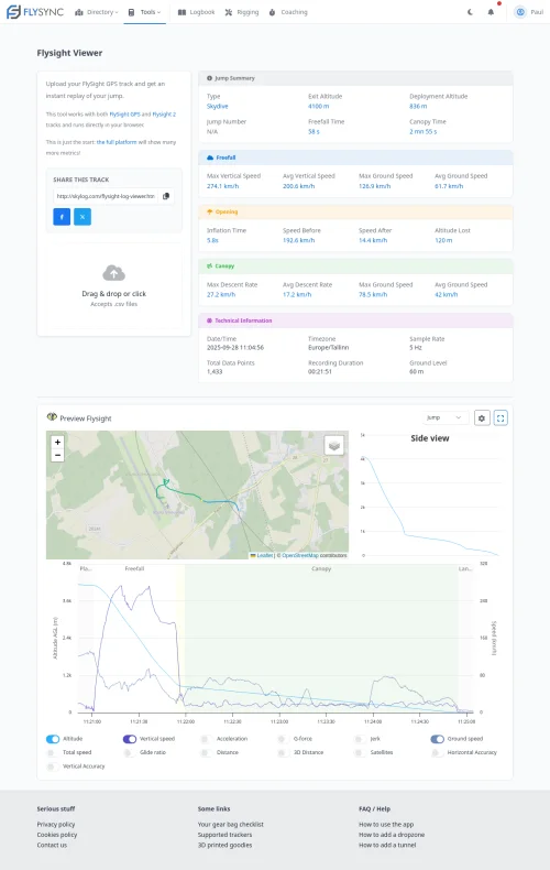
The airlogOne records GPS data alongside altitude, giving you a complete picture of every jump — including a flight path on the map.
On the full platform you will be able to store these results straight into your logbook.
What you get from a single upload
All of this, instantly, from your airlogOne CSV file.
Interactive Map
See your flight path plotted on a map with exit, deployment and landing markers.
Altitude Profile
Full altitude vs. time graph with automatic phase detection for freefall and canopy.
Speed Analysis
Vertical and horizontal speed charts showing your profile through every phase.
Key Numbers
Exit altitude, deployment altitude, freefall time, max speed, time under canopy and more.
Share & Compare
Get a unique link to share your track with anyone, no account needed to view.
Logbook Ready
Sign up for free to save your airlogOne data and build your digital logbook.